Monday, May 21, 2012

Back to Logan From California


Monday, May 21st

Our flight was at 7:00AM and so we got up at 4:30, did last minute showering and packing (leaving the busted cooler bag, some chips and peanut butter, an unopened bottle of pineapple juice, and lots of old, wet cardboard and empty boxes behind), slung our bags over our shoulders, and missed the 5:00 shuttle.  Oh well, the clock in our room was late and this wasn’t the end of the world.  We had some time to relax in the hotel lobby and drink some coffee while waiting for the 5:30, that got us to the airport in plenty of time.  Checking in took a while, but then we had no problem through security and in getting to the gate soon before they started boarding.

It was a Monday morning and the plane to Boston (jetBlue 632) was full and the gate for the jetBlue plane to New York was just beginning to heat up too.  People will move around.  It was a long flight back to Boston but they had a Grateful Dead channel on the Sirius radio and that saw us through.  Landed at Logan at 3:33 and got out to the curb with our luggage at a bit after 4, and Matt was nice enough to drive in and pick us up.  We thought it might be a rush hour nightmare getting home but we took the shortcuts and we were back to Green Street before you know it, miles and miles from California.

Weeks later I can still be struck still by the thought of how beautiful it was, the memory of the smells, the vistas, or the profuse fauna and flora that we saw.  I can also laugh at how long it took to get anywhere in California because of the distances and/or the traffic and the delays.  It was like we were stuck in honeyed quicksand at times.  In reality I suppose the traffic, the delays, and the endless people are as bad (or worse) in the Northeast than in most of California, it’s just that I’m used to it here and know the shortcuts.  Maybe in some lifetime we’ll end up in California long enough to know the shortcuts there.

Sunday, May 20, 2012

Abbott Lagoon and Back To the Bay


Sunday, May 20th

Oh no, this was our last full day in California!  We had left the day open on the itinerary and were hoping to meet up with friends of Sarah’s at some point, but there were several factors in play: what the old cars was all about was that it was American Graffiti Day in Petaluma (the 1973 movie set in the ‘50s, which apparently had been filmed in Petaluma) and the crowds were gathering for that, it was the day of the Bay to the Breakers race in San Francisco and the city would be a mess of road delays, and Sarah’s friends were driving from Sacramento and going to the Giants-As game at Candlestick that afternoon which promised a massive traffic vortex itself.

Dave and I slept a bit late again (we hadn’t gotten to bed until 1:00 or so) but made it down in time for the classic California continental breakfast.  We then assessed our situation and decided the best thing to do was to head back to Point Reyes, try to get to the airport hotel before the baseball game ended, and then meet Sarah’s friends (though spotty cell and wifi coverage might complicate things) for dinner South of the city.  We packed up Vicky for the last time … the huge trunk was just perfect for our stuff and we had come to appreciate the Crown Victoria very much, though it had its foibles.  We hit the road back through the suburban town and then through the farms and steep hills back over the ridge to Point Reyes.

Oh my God, it must have been some kind of holiday for bicyclists too!  They were all over the road like ants and were not paying attention to the cars … this was their world.  Finally we got by them and back down past the reservoir on another sunny, glorious, warm day into Point Reyes Station and then out the peninsula past Inverness and then took a right turn on the (at last) isolated Pierce Point Road out toward Tomales Point.  We had picked Abbotts Lagoon for a destination and it turned out to be an excellent choice.


We were perhaps a little later than most of the birders out at the Abbotts Lagoon parking lot (they hadn't rock and rolled all night I’m sure) and the lot was already a quarter full by the time we got there.  But we packed up our stuff, our water, and our cameras in a deuce and were out of there, down the trail through the low dunes.  The first stretch was through some cow fields, where the cows were acting a bit frisky (relatively speaking of course) on such a beautiful day.  Then the trail got into some serious winding between higher and higher dunes, across a marsh, and through endless sun-blasted shrubs and glorious wild flowers with birds buzzing all over and tweeting loudly when they alighted.  Again, the variety of life was impossible for us to catalog, though we were definitely more attuned to the environment than we had been at the start of the trip.


The trail wound downhill slowly and ended between two arms of the large, shallow Abbotts Lagoon, that dried up and then was replenished periodically when storms mashed the barrier beach just beyond it and waves flew over the dunes.  This day was less windy than the day before; we traipsed through the sand between the dunes and finally made it out to the beach where the Pacific was as roiling and fearsome as ever.  Even on a day like this, and even if the weather had been warm (or you had on the best wetsuit ever), you would have to be supremely confident in your abilities if you wanted to go swimming here.  The waves came pounding in and then sucked sand, pebbles, stray pieces of flotsam, and would have sucked innocent waders back underneath the next pounding wave up the steep shoreline if they had a chance.  If you made it past the surf out to the waves you would have had a hard time keeping your head up and then the tide would have ripped you away up the coast.  This was definitely a place for watching the ocean rather than interacting with it, though Dave and I did get our tootsies wet from a few encroaching waves.


The beach was almost washed clean of anything but miles and miles of sand, stretching to Tomales Point about 5 miles away on our right and to Point Reyes itself about 10 miles away on our left.  Nevertheless, I found a perfect sand dollar (with the old NORML logo emblazoned on it) on the beach, we found some wind- and surf-carved pieces of driftwood, and an old buoy (or mine?) that looked a little like a frog had washed up beyond the high tide line.  As we were watching the sea and the sky, we were exhilarated when a flock of pelicans flew by on their way up the coast, maybe the same flock that we’d seen down in MontaƱa De Oro, up the Big Sur coast, and then at Waddell Beach; I wonder where they’re flying now?  We love beaches and knew that when we left this one we’d be saying goodbye to California, though we had many miles to go to the airport!


OK, we headed back into the shelter of the dunes and past the lagoon where naked boys were playing in the stifling heat.  We got back to the grasses and watched some hippedy-hoppity birds jumping around after bugs.  On the way back we got some perfect shots of a quail and a redwinged blackbird when they popped right up and posed for us.  We talked with a very nice guy from Barcelona who had some excellent camera equipment and was as much or more excited about the birds as we were.  We was starved for conversation and gushed about his plans to drive farther down the point to the Tule Elk reserve next, and we gave him tips about what we’d just seen down the San Francisco peninsula, in the direction he was going next.  He was on a 4-week vacation to America … by himself … that he’d apparently been planning for a long, long time.  We talked to him about the other wonders in this country, such as Yellowstone, Arches NP, and Acadia.  He told us in a charming way, afraid that we would not get the meaning of what he was saying, that nowhere in Europe would we find places as natural and unspoiled as in the United States.  This was a reminder that, although we complain about people and the impact man has had on the environment, we need to be very appreciative of and very careful with what we do have.


Now back to the pollution of the big city!  Well, first some challenges.  We were avoiding going back into the city on route 1 even though we knew we’d see some beautiful vistas across the Pacific to the Golden Gate that way because of 1) the bicycles we’d be sure to encounter, 2) the traffic we’d be sure to encounter, and 3) the gridlock back through Mill Valley and Tamalpais Valley that we’d barely escaped the day before.  The way we chose was probably less stressful, but the road went through shady and green Samuel Taylor State Park where we saw some of the most outrageous bicycle tricks on our journey and then through the endless suburbs and stoplights of Fairfax and San Anselmo before we finally made it back to route 101 in San Rafael, just one exit South of where we’d been the night before.

101 picked up speed and then slowed down as we crested the ridge of Sausalito and then sped up again as we went downhill, through a tunnel, and wound down to the Golden Gate Bridge.  We were ready for Bay to Breakers madness, but we made it through the toll booths ($6) and over the majestic bridge without delay, and then followed route 1 South instead of continuing on 101 downtown.  We wound into and out of Golden Gate Park and saw some leftovers from the race but no untoward delays.  We cruised back through the city, past the cute houses, and were South of town before we knew it, turning East on route 380 towards the airport and then South again on route 101 towards Burlingame.  We’d been here before and ended up back at the Vagabond Inn, a week and many miles, sights, and experiences since we’d been there last.

They gave us room 117, right underneath the one where we’d been the last time, which was fine with us because we were so done lugging things up and down stairs.  We fell into the room and decompressed, while trying to contact Sarah’s friends, who were at that moment in the eighth inning of a losing game while having a marvelous time.  We started to get organized for the trip home and the game finished, but unfortunately we realized that by the time they got unstuck from traffic they would have to head right home to Sacramento and we couldn’t get together.  Oh well, that meant that it was time to take Vicky back and I left Sarah and Dave to the organizing while I did the honors.

Made sure everything was out of the car (and the business card we had found was tucked back in to the pocket where it had been), and I drove the few miles back up route 101 to the rental car return North of the airport.  For once there was absolutely no traffic as Vicky and I cruised slowly along the endless ramps to the return garage and an efficient person with a clipboard checked for dents, checked the gas (I had filled up in Burlingame), and handed me my receipt almost as I got out of the car.  We had put 1344 miles on the Crown Victoria and probably less than a tenth of that was on roads it had been on before!

Took the train back to the airport and then waited for the shuttle bus to the Vagabond Inn, where Sarah and Dave were ready to go to dinner.  We walked over to the restaurant next door but that was already overflowing with families with beepers to tell them when their table would be ready, so we didn’t even stop and kept going to the next restaurant, which was a homely (but big) Mexican place where English-speakers were definitely in the minority.  That was fine with us and they had some great food.  Sarah had combo fajitas and a house margarita, Dave had ceviche, and I had their pork carnitas dish … all of them huge.  We stuffed ourselves with their very tasty food, and then staggered back to the Vagabond Inn, where we went to sleep early since we had to wake up on Eastern time the next day.


Saturday, May 19, 2012

Do You Hear Bells Baby?? Point Reyes and Terrapin Crossroads


Saturday, May 19th

Dave and I were hunkered down in bed after another glorious day, now getting towards the end of our exhausting California trip, and we’d kind of hoped for a lazy Saturday morning.  That was not what we found.  Sarah was up and around early and there was no way she could be quiet in that small, cramped room.  But the real wake-up call came when the beep-beep of a truck backing up outside of the bathroom window turned into a deafening cacophony that Dave described later as robots fighting: probably a creaky old dump truck picking up and smashing down a series of dumpsters out in the alley.

Whatever … the Sea Breeze motel was exactly what it had advertised itself as and exactly what we’d expected, a quick and affordable motel as close as we could get to San Francisco without running into big-city prices.  The late-night crowd had dispersed the night before only when the police came and cruised the parking lot, and the crowd started up again early with some surf-casters on the nearby beach and a pack of surfers in wetsuits who seemed about as interested in surfing as snowboarders on a mountain usually seem interested in snowboarding.  They were just paddling around in the surf and having a great time bragging to each other, and probably complaining about the waves not being as high as they like them.

We got up with a groan and made our way over to the attached bar/restaurant (Nick’s Rockaway Beach … this was Rockaway Beach, Pacifica), which had stowed the live music setup and was now geared for an acceptable breakfast, though they fell a little short of a California culinary experience.  We got eggs, toast, and hash browns and they did put orange slices on our plates, but I had to ask for hot sauce and they only had Tabasco.  We ate quickly and made rude comments about the surfers, who were obviously enjoying themselves notwithstanding.  We went to get Vicky soon and she was covered with salt, having spent a wild night being splashed with surf spray.  I had to use a hotel towel to clean the windows and I apologize to the maid-person who found that gritty towel among our discarded pile.  Oh well, it worked and we wouldn’t have been able to see out the windows otherwise.

But enough prevarication … we were looking forward to a very special day and, even though the first part of the day would be spent at one of our prime California destinations, Point Reyes NS, the thing that had us almost hyperventilating was that we’d be going to Terrapin Crossroads that night.  As mentioned, we had gotten as close to San Francisco as reasonable the night before so we’d be well positioned for the drive up to Marin County that morning.  We wanted to be able to spend most of the day at Point Reyes and then have plenty of time to get to San Rafael and Terrapin Crossroads (http://www.terrapincrossroads.net/) that evening.  As touched on in the introduction, Phil Lesh (Grateful Dead bassist) had recently opened a restaurant/music club near where the Dead used to have a studio.  He and friends were playing there regularly that late Spring after an extensive Furthur (his band with Bob Weir) tour that had them in Boston in early April.  They’d only been offering tickets in person at the box office, but had recently started to sell some online, usually after they’d been available at the box office first.  I believe that all of the shows had sold out, some immediately and some (the mid-week ones) after a while.

I was checking their page every day and finally they announced another group of shows, including one on Saturday, May 19th which was perfect for us.  And they announced that tickets would be available online from the beginning!  They went on sale at 3:00PT on a Thursday in early May and I was at the computer with the mouse a-ready as soon as the clock ticked over to 6:00ET … I had the receipt for three will-call tickets in hand by the time the clock ticked to 6:01!  This was going to be a “Phil Lesh ramble” and the tickets were $75, but that was nothing as compared to the $150 they charge when Phil plays with his “Phil and Friends” band.  But Phil is a musical perfectionist and we knew that the band we’d be seeing: him, Chris Robinson, Tim Bluhm, Jeff Chimenti (from Furthur), Jaz Sawyer, Mark Karan, Grahame Lesh (Phil’s son), and Jon Graboff, would be well-rehearsed and exceptional.  We were psyched!

But first San Francisco and Point Reyes, which was easier said than done.  Though we were close to San Francisco, we still had to get through it and then North, which took forever!  We paid up and got on the road up route 1 at 9:30.  The road turned into a freeway and the traffic turned fierce, then we were all unceremoniously dumped out onto a city street, through block after block of rolling hills and the charming San Francisco houses, in pastel colors with Spanish colonial details.  We got to Golden Gate Park and followed route 1 North, twisting through the park and then the Presidio, while the towers of the Golden Gate Bridge got nearer and nearer.  Soon we were roaring up the entrance ramp to it and actually crossed the bridge at 10:00, just a half hour after we had left Pacifica … that was the easy part of that morning’s trip.

The Golden Gate Bridge is going to have its 75th birthday this year and a big deal is being made of it.  It’s three lanes in each direction and is wonderfully funky, spanning one of the most breathtaking gaps in the western coast of the US, from the classic American city of San Franciso to the hills of Marin County.  There are large sidewalks on it and one is shut down, which means all the non-car traffic goes on the other one, and boy were we glad not to be there!  There were joggers, walkers, baby strollers, racing bikes, tricycles, touring bikes, sting-ray bikes, probably unicycles, roller-bladers, pushcarts, tourists standing in the middle of it all to take pictures, Segways, and probably other stuff too packing every inch of the “sidewalk.”  No one was making any progress and I can’t believe any of them were having fun.  If you go to San Francisco, don’t fall for all the ads about taking a fun walk/bike/Segway/whatever over the Golden Gate Bridge.  ‘Nuff said about that.

We got to the Marin side and the speed limit dropped as the freeway went through some twists and turns as it climbed up a steep hill into Sausalito, and then we all picked up speed again quickly as we went back down the hill.  Signs were already warning us motorists that if we were headed for Muir Woods we were out of luck: the parking lot was full and we had to take the next exit for a shuttle bus but were probably already too late and should just go home.  We took the exit for route 1 in Tamalpais Valley anyway, which was the road to Muir Woods as well as the way we were going.  It was one big traffic jam and we agonizingly inched our way up switchbacks down into and up from the valley, heading for the coast.  Things loosened up a bit after we passed the entrances to Muir Woods in Mill Valley (which we would have liked to see, but that was out of the question because of the crowds and the time).

We were finally back to the cliffside-road-over-the-ocean milieu and the beauty returned … actually, it had never really left, even in the middle of the city.  But the big difference between this and Big Sur and South was that we were in the middle of a never-ending parade of other cars and cyclists along the twisting and perilous road.  It was then that we remarked on what we’d been noticing all along: there are an incredible number of white cars in California.  Don’t think I’m crazy, see for yourself!  There are also an incredible number of Mustangs and other hot cars, most notably Mitsubishi Eclipses.  If you tallied the number of cars that are either/or white (counting off-white and light silver), Mustangs, Mitsubishi Eclipses, or convertibles that number would equal the number of cars that are none of the above.  We had a new road hobby!

And the bicycles are oppressive.  Don’t get me wrong, I’m totally in favor of recreation and this would have been a fabulous road to cycle along, but the number of cars combined with the number of bicycles on the road made for an absolutely dangerous situation.  It should have been dedicated to one or the other, or else widened enough to not put everybody in constant peril.  And some of those bicycle riders were acting as if they owned the road … again not to argue about whether they should own the road or not, but to pass other bicycles without looking behind them (as some of the riders were doing), to turn without signaling, and to stop to take a break in the middle of the road was just obnoxious and showed a lack of respect for others sharing the road.  Oh well, ‘nuff said about that too.

After what seemed like hours (but wasn’t quite) we were only in the precious town of Stinson Beach and still slogging our way through precious and endless Marin County.  The traffic suddenly disappeared, but we still had miles and miles to go up to Bolinas and Olema along the San Andreas Fault (yes, that one), and we finally turned off into the Bear Valley VC in Point Reyes NS at 11:13.  As we got out of the car there were hawks circling overhead, the day was blue and beautiful, the air crinkled with that soft, salt, Pacific feel, and there were a lot of tourists … the parking lot was already pretty full.  We had a plan of attack for Point Reyes but the VC was at the entrance and we wanted to check with the rangers there to see if they recommended anything we hadn’t already scoped out.  Had a nice talk with a ranger (who didn't want/need to see our Parks Pass, she pointed out that this was a National *Seashore* and they are supported by our tax dollars), but this just verified what we’d already concluded, that the best hiking trails were in a totally different part of the park than the outer, jutting-out-into-the-ocean part we really wanted to see.  So this was pretty much a waste of time too (though scenic) … we got back in the car and headed out to the point.

However, to get to the point from the peninsula entrance is a long drive itself, part of it through more precious towns where everybody slowed to 20 and looked for an antique store or an art gallery.  Then suddenly we made it out to the rural, wild part of the point, where farms pop up along the route, the road narrows and becomes full of potholes (from the farm equipment probably), and you’re surrounded by cows (also at times the smell associated with them).

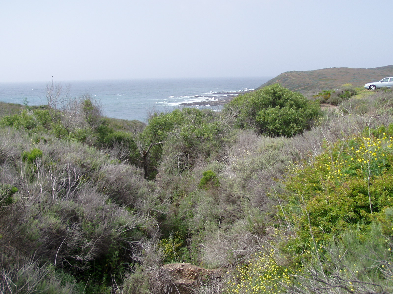
Whatever … it was beautiful and this was the environment Sarah and I remembered from having been there in ’86: long fields leading down steep hills to salt marshes filled with grasses and birds and beyond that the endless blue of the Pacific, all spiced with a hard, chilly, merciless wind.  At last we made it out to the Point Reyes Lighthouse parking area at 12:02 (2 ½ hours after leaving Pacifica, though this had been some tough driving and it seemed like forever) only to find the parking lot full.  Cars were spilling out of it and parking on the sides of the narrow road, so we did the same and then got out and walked up to the lighthouse attendants’ dormitory and the sprawl of small out-buildings.


The California coast is very jagged and tricky for mariners and the constant on-shore breeze has been piling people up on the rocks for centuries.  A place like Point Reyes is even tougher because it sticks out so far from the shore and is so isolated.  Actually, in its Southern lee is a peaceful (well, relatively) cove called Drake’s Bay where Sir Francis Drake stopped to repair his boats and hide from the Spanish Inquisition (and then come back home to England and defeat the Spanish Armada).  But the Point itself is a nightmare of several-hundred-foot cliffs, treacherous rocks, strong currents, and the ever-present wind … some of the highest winds ever have been measured at Point Reyes.  And the Northwest coast of the peninsula is a long, long, long ocean beach with deep water just offshore that’s just perfect for shipwrecking unsuspecting boats on a dark night.


Anyway, the point is that people put a lighthouse out there long ago and that tending it has been one of the worst jobs ever since then.  Have you seen The Horror of Fang Rock (a Dr. Who episode of course), where lighthouse keepers go crazy and corpses come back to life?  Well it was just like that for much of the existence of the light.  Modern technology has made things much better for the lighthouse keepers, but I’m sure that job is still crazy-making, especially in the dead of winter when there’s salty ice all over the cliffs, weeks and weeks of fog, and the wind is at its most fierce and the temperature drops below zero.


We didn’t stop in the small VC out at the Point; it was packed because most of the people who’d parked at the end of the road and then walked the half mile out to the Point itself did not want to then walk down the 300+ stairs to the lighthouse in a perilous ledge of the cliff and then back up.  But we did, that’s what we were there for!  When you walk down there you can tour a nicely restored building that used to be the dormitory and weather station for the keepers, small outbuildings that held coal and oil, and the house itself with a really nicely-restored works and huge Fresnel lens.  Just below the lighthouse is the modern station, with a stronger light and an automated horn, both of which rarely require attendance compared to the constant tending that used to be needed.


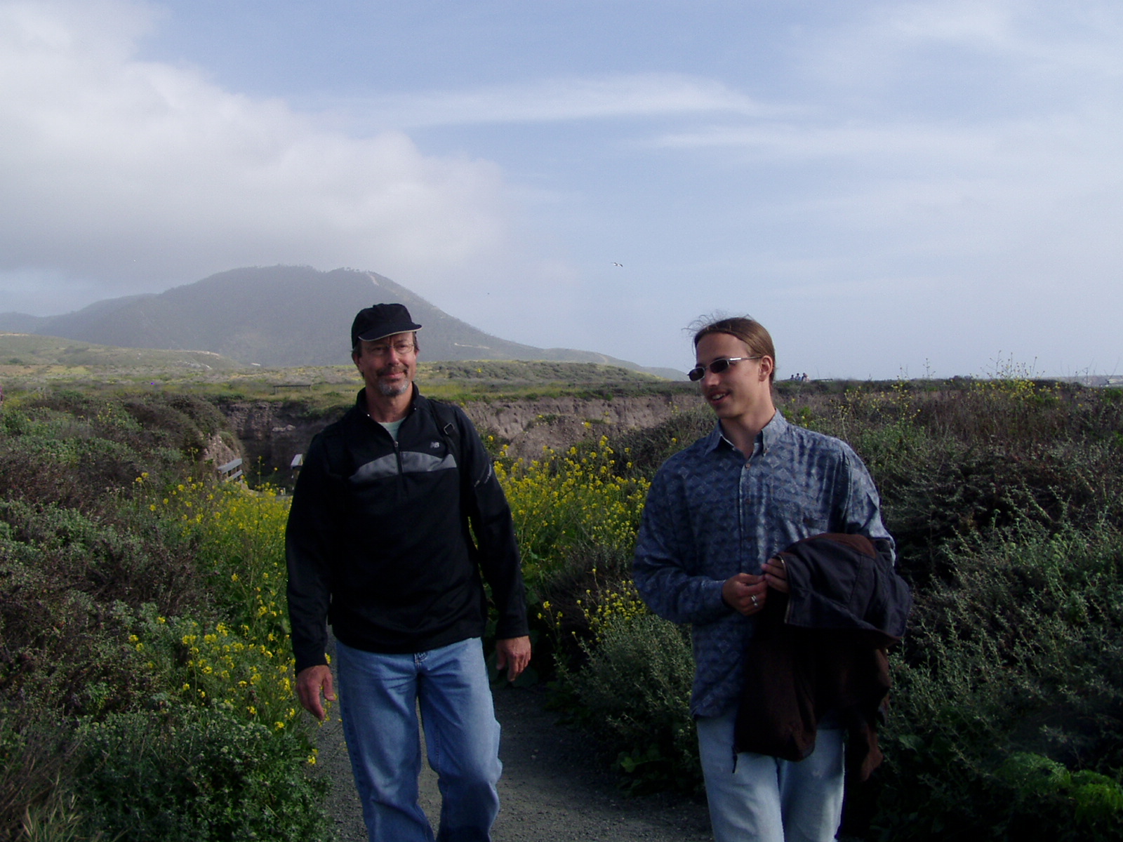
We stood there and soaked in the sun but were battered by the wind, the chill, and the feeling that we were in a place where man didn’t belong.  It’s no wonder that the old keepers went cuckoo like clockwork.  We climbed back up the long stairway chiseled into the rock, and marveled at all the wildflowers even out there in the rock, and at the persistent conglomerate that topped the granite.  Back to the top, then down the road past the row of vultures hovering above the Northwest cliffs in the high wind, and then back to the parking lot, where we jumped in the car and headed down towards the salt-water farms, then turned right out the lonely, one-lane (or at least very narrow) road to Chimney Rock.  We weren’t alone out there, but thankfully the crowds hadn’t (yet) followed or preceded us out there and we pulled into the 100-space lot with a few other cars in a hollow of the point, where we had a lovely view South over Drake’s Bay and some shelter from the wind.

“Some shelter” was not much though.  There was one picnic table there but the people who had claimed it didn’t even try to put their food out because the wind would have whipped it away in a second.  We were starving and there was a shuttle bus shelter there (not in use in May), so we lugged our lunch stuff over to it and huddled in its shelter to make and eat sandwiches.  Some sort of colorful swallows had apparently been busy all Spring making nests in the shelter and so were very annoyed with us taking it over.  They hovered just outside, shaping their wings to swoop back and forth across the entrance but not daring to come in with us there.  Silly swallows!  We were just having lunch and would not have eaten them.  We finished quickly however, lugged the stuff back over to Vicky, and then found the trailhead out to Chimney Point.


The old lifeboat station was on the shore below us, probably in the most sheltered cove of the bay but still wild.  Some sea lions had taken it over and were arrayed in repose all around it.  The wind increased to a gale as we walked through the beautiful meadow of grasses and wildflowers beyond it, slowly rising up toward the crest of that tip of the Point Reyes peninsula, and then had a full view of the Pacific glittering to our right while the deep blue and white-caps of the bay extended in front of us and to our left.  The trail gets pretty narrow along the ridge out towards the point and there are signs all over the place warning people not to go near the cliffs, since they might crumble and dump you several hundred feet down among rocks, surprised sea lions, and pounding surf without hope of rescue (even if you survive the fall).  It’s amazing the number of people along there who didn't heed the signs, a succession of Darwin award candidates.


Made it out to the end of the trail and were a little disappointed that Chimney Rock is not more spectacular but what the heck, everything about the place was breathtaking!  We hung out there for a little bit but the wind was overpowering and we turned around and made out way back up to the ridge trail and then down the trail into the hollow that marked the parking lot and the turnoff to the lifeboat station.  This was yet another in the string of remarkable, lovely, brilliantly colored, exotic places that we’d seen during our California vacation and we hung around a bit more when we got to the parking lot, walking a ways down another trail that eventually led down a precipitous path to Drake’s Beach.


But then it was time to go.  We got back into Vicky by 2:33, knowing that it might take a couple of hours to get to our hotel and get prepared to go see Phil Lesh that night.  Woohoo!!  We were psyched all over again!!!  We drove back down the narrow Chimney Point road, through the cow farms, past the beautiful meadows and bird marshes, through the small precious towns, and then exited at the funky intersection of Point Reyes Station.

We pointed the car up the Point Reyes-Petaluma road and pressed the pedal to the metal, past sunny Nicasio Reservoir and over the sharp hills and sudden valleys through the farms and ranches over the 20 miles (though it seemed like three times as long) to Petaluma.  Petaluma is a pretty big town on route 101 and was the closest-to-San-Francisco point to the North of town where we could get good hotel rates without getting into the really high prices or outrageous bed-and-breakfasts.  We had a room in the Best Western there and it was quite a relief to pull into a pretty empty hotel parking lot in the raging hot sun (no wind here!) by 3:42.  We checked into room 249, unloaded just the stuff we had to, and then Dave and I went for a swim in their pool to cool down and a shower afterwards to wash off the chlorine.  Dried off, got dressed in appropriate gear, and then we were off South to San Rafael and Terrapin Station at 4:50.

We crossed back over route 101 in Petaluma and turned South on it for the 22 mile drive to San Rafael.  You have to do a little whoop-de-do off the highway to get to Francisco Boulevard and Yacht Club Drive … Terrapin Crossroads sits among car dealerships and a marine fittings store, but has a nice sign on the road and is hard to miss.  Who doesn’t notice a Terrapin playing a tambourine?


There seemed to be a crowd already, but it was just 15 people or so milling around in front.  Finding a parking place was no problem, even though Vicky was totally out of place among Deadhead vehicles.  We walked dazed towards the building in the hot late afternoon, somehow slightly afraid that this was all a dream and we’d be turned away.  But we checked out the place a bit (which marked us as true Deadheads to the people hanging around … we weren’t rushing anywhere; one of them said “Yeah, Barton Hall!” to me when he saw my Ithaca College t-shirt and was delighted when I responded, “We were just listening to that, great Morning Dew!”), figuring that that closed building that was thundering Terrapin Station from inside (apparently the sound check) was the performance hall and the one with people in it was the restaurant …brilliant!  We targeted a door in the restaurant and walked right in.

The people at the maĆ®tre d’ station were still not quite done with setting up at 5:30 but we told them we had a reservation for that time and waited patiently while they got their act together.  This gave me a chance to ask the key question of one of the guys.  “We’re from Massachusetts,” I started.  “Oh … I’m so sorry!” he said.  Basically what I wanted to know was what we had to do to get a good spot for the show.  We had come all the way from MA, we were there early, this might be our only opportunity to see Phil and Friends up close, and we wanted to know what we had to do and we’d (within reason) do it.  He understood and was very helpful: “You see those people outside?  Well that’s the line,” he said.  This meant two things: 1) that we’d have to get in the line at some point to get in and 2) that we didn’t have much to worry about since there weren’t hundreds of people there already, there were just 20 or so freaks totally enjoying themselves.

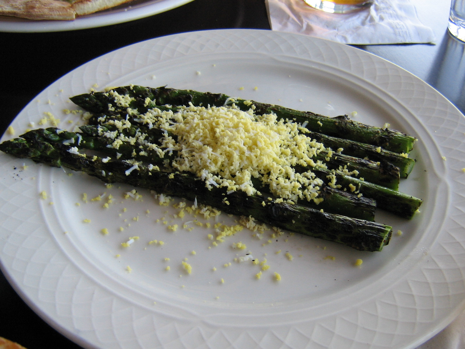
Then they escorted into the restaurant, giving us a choice of sitting out on the deck overlooking the canal or sit just inside.  We had a hard time deciding, so they nicely put us at a great, comfortable table just inside the open glass doors that overlooked the flower-filled patio.  It’s really a pretty place that used to be a fancy seafood restaurant, it was only about a sixth full when we got there and was maybe half full when we left … they could even squeeze in a lot more tables if they needed to, lots of room to grow.  A very nice, laidback, and efficient waitress named Celeste (our age??) brought us a big carafe of “twice-filtered water” right away and took our beer/coffee order (Lagunitas, see above).  We were a little nervous about not spending too much time over dinner, but she brought the drinks quickly and then took our food order.  I got an asparagus, basil pesto, grilled onion, and goat cheese pizza, Sarah got a fancy cheeseburger with excellent pickles and fries and a side order of grilled asparagus with Spring garlic butter and boiled egg, and Dave got a pizza with portobello mushrooms, sausage, arugula, and fontina cheese.


The food came quickly too and was excellent!!  Everything about it was incredible: the presentation, the ingredients, the preparation, and most of all the taste; this was the definition of artisanal food.  I guess a place like Terrapin Crossroads attracts great talent … I’d like to work there!  I have to mention the crust of the pizza, which was the lightest, most flavorful pizza crust I’ve ever had, not to mention the basil and the asparagus.  The Lesh family envisions Terrapin Crossroads as a center for the arts, and culinary arts is one of them, at which they do exceptionally well.

In the middle of the meal it turned 6:00 and the “box office” (which was a card table outside) opened up, so I went and got my will-call tickets with no hassle.  We were so psyched!  If the food hadn't been so incredible we would have been too nervous to eat anything, but both Dave and I finished every crumb of our pizzas and Sarah did the best she could with the massive amount of food she had.  We were exhausted from the schedule we’d been keeping and it had been a long day, so after one beer I had a cup of their staggeringly delicious (of course!) coffee, which woke me up fine.  We finished by 6:15 or so and paid up (Celeste put a smiley face on our bill, so Dave drew her a stealie on her copy).


OK, it was time to get in line!  We walked outside, trying to hold ourselves back from running and be as mellow as everyone else.  The “line” still hadn’t grown much in the interim and we kind of hung out at the back, and when other people came after us they were mellow too and kind of hung out behind us.  This was a crowd with an aesthetic, and that was to be respectful of the place and the other people … just wonderful!  Right behind us was a goateed, middle-aged guy by himself, from Houston where he taught (oenology) at the University.  He was on a business trip and was delighted, excited, and thrilled to have the chance to go to Terrapin Crossroads for the first (and maybe the last) time ever, just like us.  Another guy we talked to was the dread-locked and bare-chested one who had commented on my t-shirt; he was from Oregon and this was also his first time there, a long distance to travel and a stiff price for admission.  But he was full of stories about seeing the Dead, etc. in Oregon in the past and he just had to make a pilgrimage down to San Rafael.  Again, this was what we found in California, that half of the people we talked to were from away and were very excited about having the chance to be there.

The immense crowd of out-of-control Deadheads (note sarcasm) swelled to 30 or so by the time the doors opened at 6:30 for the 7:30 show and you should have seen us stampede the three entrances they opened!  Well actually, there were not a whole lot of us and everyone was very polite and waited his or her turn.  We got wrist-banded, ultraviolet-logo-stamped, and then headed right into the hall, where some people took the bistro-style tables along the outer edges of the rectangular hall (there were a few tables and these people who had obviously been there before wanted a seat rather than moshing with the crowd).  The rest of us stumbled around in a panic trying to decide where we wanted to stand: right in front of Jeff’s full keyboard setup (with organ, electric piano, synth, and Leslie), center stage in front of what would probably be Chris Robinson’s mike, close to the bar, or where most of us ended up, in the Phil zone.  The guitars were in their stands and Phil’s brown six-string was what we all gravitated towards.  Then we all looked at each other and smiled and relaxed; half the people sat down (nice soft-surface floor) and the other half headed for the bar to get drinks.

Yeehah!  Nice beer, nice people, nice rock and roll stuff all around us with Grateful Dead logos on it, and a wonderful, small hall that looked like they could pack in a couple of hundred people at most.  I have to say that this was one of the most fun times ever, everyone there was so excited and so mellow at the same time.  By 7:30 the place was only about half full when Grahame, Phil, Chris, Jeff, and the others (Tim Bluhm wasn’t on stage for the first number) came out and started tuning up.  The hall filled up *really* quickly at that point, most of the people barely exhaling by the time they entered … it was like a wave of pot smoke coming in from the parking lot.  And then the band launched into Sugar Magnolia (sung by Grahame) and we all started jumping up and down and freaking out.

Here’s the first set list: Sugar Magnolia (Grahame, with Phil and Chris), Operator (Chris), Dire Wolf (Tim), Appaloosa (Chris), I Need a Miracle (Chris), Mason’s Children (all, of course), Liberty (Grahame and Phil).  Geez, now I have to say something coherent about it!  Perhaps the most wonderful thing for me was that it was a new slant on GD music, since the lineup was so guitar-heavy and the band was all about hitting the hard edge of the songs and milking them rather than letting them speak (or not) for themselves.  Sugar Mags was the opener and was a show-stopper, Grahame was covered with sweat by the end of it he emoted so much.  Chris Robinson just impressed the hell out of us; he strummed rhythm and slurred his vocals but got all the words right and was so on top of the loneliness of Operator and the false braggadocio/wanting of I Need a Miracle (not to mention the song he wrote, Appaloosa) that the crowd was on his side immediately.  Jon Graboff on steel contributed such a new, funky, wired sound to the music and Mark Karan provided a more than driving lead guitar.  Jeff Chimenti was as marvelous as always, Jaz Sawyer knew how to play tasteful drums to 4-5 guitars and stayed in the background, and Grahame was just dynamic.  And then there was Phil, who at the age of 72 still gets better and better each time he takes the stage.

We were dancing and dancing.  There was this tall, old guy standing about halfway between me and Phil’s speakers and he sometimes blocked the sound from them … his name was Phil Lesh.  Most of the band members were wearing in-ear monitors and Phil could speak to them without speaking to the crowd so we missed some private jokes that had them all grinning and some musical directions that had them all nodding at Phil.  They were very well-rehearsed and each one knew exactly what his role was in each song, but then didn’t hesitate to show virtuosity and ensemble-awareness when he had the chance.  As mentioned, Chris was rhythm and Mark was lead but when Jon got his ethereal steel breaks and when Grahame stepped out and especially when Tim played his numbers (on which he was unquestionably the rhythm guitarist) they all got muddled around and ended up delivering some of the finest ensemble guitar sounds I’ve ever heard.  Those guys had my head whipping back and forth to follow it all but those of us in the Phil zone were the most fortunate.  At several times during the concert I had to remind myself that I’d (probably) never get a chance like this again to see Phil the master at work and when you stood there and watched his fingering and felt the sounds he was making then that made you realize that life was good.

The guys took a set break and we all hit the head, and then some of us lined up for more beer while the majority of the crowd scattered throughout the parking lot.  Crammed back in for the second set and we were a bit more squished while people tried to edge in where we early arrivers had camped (some people didn’t believe that Dave was defending his mother’s spot), but we were still just a few people from the stage.  Here’s the second set: New Speedway Boogie (Chris), Loser (Chris), He’s Gone (Grahame), Scarlet Begonias (Tim), Fire On the Mountain (Chris), Saint Stephen (all), Terrapin Station (all, with Chris and Phil doing the leads).

This was more tight, beautifully expressed, wonderful music (see May 20 post here).  You think of Speedway as kind of a simple song that you’ve heard many times, but they turned this into a serious gymnastic jam that lasted almost 20 minutes, let each instrumentalist shine, and then it was just hijacked and taken higher and higher by Jon Graboff on pedal steel.  Chris was back to his emotive, bluesy best vocals on Loser, and Grahame and Tim then kept up the vocal pace on He’s Gone and Scarlet … the vocals were one of the best parts of the act.  After Scarlet they suddenly stopped right when we were ready for Fire because the in-ear monitors were screwing up.  This was a fortuitous break as it turned out, time for another quick bathroom break and another quick stop at the bar before they came back out and just whipped into an excellent Fire On the Mountain with Chris wailing about the long distance runner and the fears we’re all running from.

A decent Saint Stephen (which for once showed a small lack of practice) then led us to the crescendo of the whole night: the best Terrapin Station I’ve ever heard.  This was what we’d heard them practicing when we arrived and they had it down!  This song easily can be dominated by the story, the musical theme, the vocals, or the bass line and I’ve heard every one of those variations, but this time all of the band knew their roles and played them to perfection.  It was Phil’s show of course and he opened with the Lady With a Fan section, but the overriding image of that number was him thrumming the bass notes and singing beautiful baritone harmony to Chris’s emotion-filled lead on the “spiral light of Venus” verse.  This was again, such an excellent ensemble sound.

They took a short break after that while we all jumped around a little more, trying to catch every bit of delight we could.  Soon we’d be leaving the new friends we’d made (and going back to Texas, Oregon, Massachusetts, or wherever) and there were some hugs in the crowd.  Phil came out and played gracious host, then launched into his donor rap which we all applauded.  And then the whole band came back out (5 guitars now, counting the pedal steel of course), launched into a cacophonous, throbbing, rolling sound, and then everyone in the building joined in with the vocals as it melded into a rocking Going Down the Road Feeling Bad.  How could we be disappointed after a send-off like that (well, *then* doing One More Saturday Night would have been ok with us but we weren’t complaining)?  Roadies came out and handed out a few copies of the set list … we got one!

Sad to leave that special place but it was time to go and the night was waiting.  Got back into Vicky and slowly cruised out of the parking lot and then the whoop-de-do through a little of residential San Rafael back to route 101 North and the rolling hills up to Petaluma.  The parking lot of the Best Western was absolutely packed with old cars when we got there!  Kind of a strange sight but we managed to squeeze Vicky into a parking space and find our way back up to our room.  We were exhausted and even though still buzzing from the thrill we’d just had, it was off to sleep quickly.


Friday, May 18, 2012

Driving and Hiking On the Big Sur Coast


Friday, May 18th

Sarah was up way before me and Dave again, but I made myself get up relatively early because we had a long road in front of us that day.  This was going to be what had been at the top of my wish list for a California trip: driving along the coast for miles and lovely miles.  I had thought to drive the (more) deserted coast along the Cape Mendocino area of Northern California, but many people will tell you that the Monterey-Big Sur coast is one of the most beautiful places in the world and so we figured that would do.

We also wanted to meet up with our friend Tony in Santa Cruz; we’d left each other messages on Facebook and his latest message said to meet him for dinner at Hula’s Grill in Santa Cruz … worked for us and the plan was that we’d call him from the road when we had a better idea of our timing.

Took a short walk with Sarah down to where the hotel’s parking lot overlooked the beach.  You couldn’t actually get to the beach without climbing walls and/or crossing private property but the hotel didn’t lie when they said they were beachfront … just misled people with the implication that this meant you could walk on the beach.  We returned to the lobby for the textbook continental breakfast.  I grabbed the only onion bagel they offered and it was good.  Dave showed up and had a bit of cereal and pastry and then we filled up our road coffee/tea cups (one thing they do right in CA is they usually have good tea selections) and screwed out of there.  Filled up the wounded ice bag, threw our stuff in the car, and hit the road back up the small hill out of town to route 1 North by 8:45 … we were on our way to Big Sur!

As mentioned, planning for the trip had been difficult and we’d spent a lot of time reading about, re-reading, and trying to place geographically the hikes in the California’s Coastal Parks book we had.  The book had steered us to MontaƱa De Oro so that and the credentials of the author made us feel that we should trust what it/he was (very poorly) trying to say.  Some of the maps were as informative as those on Entrances to Hell UK.  Added to this was the fact that we wanted to hike on somewhat challenging trails, but we didn’t have the legs or the time to hike for miles and miles up the coastal mountains just to get a nice view.  And we wanted to see Coastal Redwoods, that was a definite.  At length we’d developed a plan, which was to hit a beach/dunes/bluffs trail first (we’d done that yesterday), and then to do a hike up the hills to the redwoods.  After much study of the book, we decided to cast our fates on the Kirk Creek Trail, and perhaps Limekiln State Park after that.

And we wanted to leave time for our old friend serendipity (as Ol’ Sinc used to say, “Serendipity is the best dippity”).  We traveled North for half an hour or so and passed a few small towns where the cows outnumbered the residents, passed the popular San Simeon State Park with its long pier, and passed the turnoff to the Hearst Mansion where most of the other cars on the road turned off (good riddance!).  We motored by ourselves further North and the beautiful Pacific and the brightening day and the wispy clouds were beginning to make us think that we really should stop and get out of the damn car.  Suddenly there was an “elephant seal overlook” and we pulled in with what turned out to be a very big crowd in the parking lot of the Piedras Blancas Elephant Seal Overlook.


There were two busses full of school kids on an educational outing.  How come I never got to go on field trips as entertaining as this?  We looked over the bluffs about 20 feet down to the beach and saw hundreds of elephant seals, some passed out on the beach, some mock-fighting each other for the best spaces, some protecting their babies from being rolled over on, and some (the bulls) roaring at rocks and whoever else would listen.  The majority of them were piled up on the beach in a cove a few hundred yards down the shore and that’s where all the school kids and most of the tourists went but the action was just as entertaining right by the parking lot where we were.


And we were delighted!  How could anyone not see the comical similarity to Dr. Who monsters, especially when the bulls roared at rocks because they were looking at them funny, and then got blind-sided by a wave.  There were ground squirrels all over and many of them were dashing around the beach among the monsters (like Dr. Who companions), digging up some things and burying others.  We watched the animals, the waves, the sky, and a flock of pelicans flying up the coast, perhaps the same flock that we’d seen flying in the same formation, in the same direction, yesterday evening 50 miles or so down the coast.  Then we got back on the road.


We passed the topless Piedras Blancas lighthouse and screamed for miles and miles up the incredibly scenic coast.  We stopped again about 45 minutes later at another turnoff, high on some steep bluffs over the ocean in the mid-morning where the colors were just surreal they were so brilliant.  The rocks far below were black and white (bird droppings) lumps in the frothing waves, white streaks flew through the sky with the wisps of surf, the clouds, and the tiny bits of fog/mist, green grass and shrubs clung to the edges of the perilous cliffs, and every visual was heightened by an incredibly pure blue background, whether it be the sea or the sky.  We chatted with a bike rider from Pennsylvania; it was her first time ever here and that was the rule all through the trip, we met as many or more people “from away” as we did natives.  The turnoff had a steep path down and down to the beach and we considered it for a second, then slapped ourselves in the faces and got back in the car … we should stick with plan A … not long now to the trail we really wanted, Kirk Creek.


Drove some more up the coast and saw the turnoff for the Nacimiento Road, the Kirk Creek campground on the left (already pretty full, probably with people who’d taken Friday off, driven down the coast early, and grabbed a prime campsite on beautiful Jade Cove), and the small pull-off on the right that the book had told us about.  We were the only car there, actually making it to our desired trailhead by 10:40!  We stuffed our usual trail stuff and some extra clothes into one pack (I got the honors of course) and hit the road up what was officially known as the Vicente Flat Trail in the Ventana Wilderness.  We didn’t anticipate that we’d make it all the way to Vicente Flat but our goal was to climb up and up into the coastal mountains until we saw some redwoods or died in the attempt, and then to climb back down when we saw fit.


Oh God, here I go again.  We were instantly surrounded by beauty; this wasn't the astonishing beauty of Yosemite or the breathtaking beauty of Sequoia NP or the mind-boggling beauty of MontaƱa De Oro … this was a shocking, pervasive sense of beauty as the steepness and lushness of the hillside, the incredible views up and down the coast, the intense colors and graceful shapes of the wildflowers, and even more than anything the soft, cool saltiness of the sea air and the spice of the burning sun all combined to make us stop time after time and say WOW until we just couldn't say that anymore.  There are several sites dedicated to this trail on the web, but imagine how much more incredible it was at the height of wildflower season than in those mid-summer pictures.  For a couple of hours (it seemed) we walked up and up and up gradual switchbacks back and forth along the amazingly steep hillside until we were towering over the coast.  The top of the ridge kept getting closer and closer but still kept staying maddeningly far away.


To be fair, not everything was perfect in paradise.  We also saw lots and lots of Pampas Grass, which we first thought was another charming native species, with its agave-like leaves and its fluffy center flowering stalk.  But we realized that in the patches where it was it was taking over and making a little mono-culture for itself.  We later found out that it’s an invasive species and who knows?  In a short amount of time that whole hillside could be the mono-culture of Pampas Grass.  That’s a very disturbing thought and I hope something can be done to prevent this.


We probably climbed from sea level up to about 1600 feet that day, stopping several times to take pictures, rub on sunscreen, or take drinks of water.  Again, I can’t even begin to catalog all the wildflowers, grasses, shrubs, and trees we saw that day, partly because there were so many and mostly because we had no idea what they were called.  At one point we were looking closely at a bit of speckled rock and realized it was a large snake, interrupted in the midst of its vertical slither up the hillside.  We saw all kinds of birds as well: chirping in the shrubs, flitting about our heads, or soaring into the blue sky.


Then a couple who started just behind us (they were in shorts, we three were all wearing long pants and hiking boots) and had surged ahead of us came almost running back down the trail in a panic, and warned us that soon we’d be in the tick zone and they’d be jumping all over us.  Well, we weren’t about to stop at that point!  We had a full can of insect repellent and we basically soaked our pants with it, then kept going.  Another thousand yards or so up the trail and we were suddenly in that zone they were talking about, but the ticks were probably made somewhat logy by the stinking pants they landed on and we were able to see them and brush them off before they could climb up much beyond our thighs.  Oh a couple came close to the belt, but we managed to fend them all off.  Dave regretted the fashion choice of jeans with holes in the knees but it worked out all right.


As suddenly as the zone began it was over, coinciding with a turn of the trail into a shaded canyon filled with redwoods.  Have I mentioned how beautiful everything was?  To be up in the middle of the air in an incredible environment like that (though besieged by ticks), and then to suddenly fall into a cool canyon with the tallest trees on the planet, arrays of ferns, some moss-covered rocks we could rest on, some maples and oaks for shade, and an incredible quietness in which you could barely, barely hear the whoosh of the ocean thousands of feet below was like being in some magic grotto in a fairy tale.


I’ve mentioned Coastal Redwoods before and the ones in this ravine weren’t the best specimens, but they sure were awesome and towering.  They were also very dark from the flash fires they’d survived over the years.  We rested for a while and then pressed on up the trail, hoping to make it all the way up to to the ridge or to another redwood canyon before turning back.  We were approaching another one after trudging uphill for half an hour or so, but we’d been through another tick zone (we’d re-soaked our pants at that point) and were beginning to wonder if it was worth blowing the rest of the day by continuing.  It probably was (have I mentioned the beauty?), but we were getting hungry and running out of water, so we eventually decided to head back down.


Going back was trickier than you might think because what was a steep gravel/dirt path on the way up became a sliding hillside at times on the way down.  It was the old truism that walking downhill is tougher on the shins, knees, and ankles than walking uphill.  We had soaked our pants a third time (just about emptying the recently-full bottle of repellent) and thankfully the ticks mostly left us alone on the way down (“Here come those people with stinky pants!”).  We stopped in the redwood canyon again for a rest and a few chips and met another couple with their happy dogs (only the second group we’d seen on the trail).  We mentioned the ticks and they said that yeah, these panicked people had arrived at the trailhead just as they were starting up and almost begged them not to chance it.  I guess those people were kind of freaked out by the ticks.  The ones we saw were probably Western Black Legged Ticks.

All good things have to come to an end of course, and we descended the trail about twice as fast as we had ascended.  We were soon close enough above route 1 so we could hear the cars (as well as the pounding surf on the shore), made it down past the lushest flower elevation, passed several other groups on their way up when we got near the bottom, and then made it back to Vicky at 1:44.  Another great hike!  This was not the only high point of our trip by any means, but was among them.


We were starving, but realized that the Limekiln State Park was just a few more miles up the road and would probably have shaded picnic tables (if they weren’t all mobbed) and would be a nicer place to recuperate from our hike than alongside route 1.  So we drove the bit up to the well-hidden turnoff for Limekiln (which was another recommendation from the wonderful Coastal Parks book) and they wanted $8!!  I was a little taken aback at first but then we paid it gladly … CA State Parks have had a rough time with recent state administrations and are in dire need of cash and it’s a horrible thought that we could be so short sighted to let any of them disappear.  They need our support.

In exchange for the small entry fee (and our support) the guy gave us a trail map and plenty of advice.  He told us that if we wanted we could turn left and go down to the beach or turn right and go up to the parking lot for the Redwoods Campsite, where there were a few picnic tables.  The trailhead for the path up the creek was there too.  So we turned right and there was only one other car in the parking lot (those people never showed up and mysteriously left at some point), and we did not see another person for the next couple of hours.  This place was worth more than $8.

Dave made the peanut butter and jelly sandwiches that day as Sarah and I watched.  The peanut butter tried to explode on him but we coached him through it.  We were sitting at a picnic table at the bottom end of the deserted (not yet open) campground, next to the raging Limekiln Creek, watching the redwoods, the mossy rocks, Redwood Sorrel, manzanita bushes with their trademark red stems, the tall grasses, the green and yellow shrubs, and the songbirds.  After lunch we put the food stuff back in the car (no bear boxes on the coast) and then started walking up through the campground to the trailhead for the Lime Kilns themselves.


These were some tall, majestic redwoods … mostly second growth but some first growth.  We climbed up through several named groves and then kept on following Limekiln Creek up the Falls Trail rather than going to the kilns.  We had to cross the creek five or six times on some dodgy-looking branches and/or stepping-stones to keep going, but we could hear that there was a big falls up at the end of the trail and we finally made it there.  Limekiln Falls is only a hundred feet, but in the Spring there’s a great amount of water coming over it and it had made a sculpture of moss, lichens, algae, rock, tumbled tree branches, and ferns that shone in the afternoon sun in the middle of the brown, gray, red, and green forest.  Dave and I climbed all the way up to it and stood in the pool at its bottom as we gazed up at the water falling out of the clear blue sky.


We turned around to head back and, as happened time and time again on our California trip, on the return trail we met all kind of people coming up: about 7 groups in all after we’d had the place to ourselves for a couple of hours.  By the time we made it back to the parking lot it was almost full … where had these people been and why were they tracking us?  We threw them the slip again though and jumped back in the car, said a sad farewell to the lovely Limekiln State Park, wound back up the twisty entrance road, and floored it North on route 1 at 3:20.

We had told Tony that we’d call him at mid-day but the problem was that we hadn’t had a cell phone signal since leaving Cayucos.  We roared by the really popular Julia Pfeiffer Burns State Park and Pfeiffer Big Sur State Park, where the parking lots were full and chaos abounded.  We went on for mile after mile after mile up the coast, finally arriving in the super-rich town of Carmel 90 minutes or so later, and then the traffic started as we would up route 1 past Monterey.  Sure seemed like we’d never get to Santa Cruz at that point, but at least there was cell coverage there and we could contact Tony and make our tentative plans a little more exact.  The road turned into a limited access highway and the traffic fell behind as we wound through the major towns around Monterey Bay, then we broke free and had another 20 or so miles of beach before we stated approaching the sprawl of Santa Cruz.

Contacted Tony again and he gave us specific instructions that Sarah was able to augment with the help of Google Maps on her Kindle.  We pulled into downtown Santa Cruz where there were a lot of people, buildings, stores, and cars … and they all seemed to be having a great time, especially on a sunny, Spring, Friday evening!  We found a parking place for our out-of-place big boat of a car with only a little difficulty and walked the few blocks over to Hula’s Island Grill, where we met old Tufts friend Tony and had a great interlude, talking about the trip, old times, new times, Tony’s life in Santa Cruz, and having some great seafood.  I had a barely seared ahi tuna steak, Sarah had awesome sea scallops, Dave had a Cajun burger, and Tony had ahi sashimi, veggie rolls, and seaweed salad (I tried some of it and it was delicious).


Sad to say goodbye to Tony, but we still had a substantial trail in front of us (or behind us … my internal compass was a bit off as Santa Cruz harbor really points East!), but we tanked up Vicky and got batteries at Rotten Robbie, and made it out of Santa Cruz by a little before 8:00.  Sarah called the hotel in Pacifica to say we'd be late. "What time will you get here?" they asked.  "I don't know,” she said, “We're trying to get out of Santa Cruz without killing any pedestrians right now."  We had to head up the coast another 70 miles … but before we did that we had one more stop to make.

The sun was setting into the Pacific to our left and just at the right time, there was a beach: the Waddell Beach area of Big Basin Redwoods State Park.  The crowds were already gathered there to watch the beautiful, orange sunset.  We pulled over at a few minutes after 8:00, put on whatever jackets were available (it was chilly and windy), and stood out on the beach, watching the angry ocean turn from blue to green to black and watching the circle of the sun approach the horizon and then flatten out, and then disappear.  Believe it or not, as we were watching another flock of pelicans flew by … or was it the same flock that we had seen in MontaƱa De Oro the day before and then at the elephant seal overlook that morning?


Time to hit the road once more and we roared past Pigeon Point as the light faded and then Half Moon Bay as it became darker and darker.  We made it up to Pacifica sometime before 10:00.  We were now really back in civilization in this southern suburb of San Francisco.  We had made a reservation at the Sea Breeze Motel, right on the ocean again, and when we pulled into the parking lot it was packed with Friday-night partiers there to hear the live music in the bar next door.  We got a space on the side of the parking lot facing the wild sea (or so we assumed from the sound and the spray, though we couldn’t see it), checked in in the small office, and then squeezed into a room less than half the size of any of the others we’d had so far.

Oh well, it wasn't as small as our room in Paris had been!  The beds were not queens (as advertised) but we made do, somehow got our stuff stowed and got us relaxed, and then fell asleep sometime soon after that.


Thursday, May 17, 2012

Said It Before and I'll Say It Again, Across the San Joaquin To the Coast


Thursday, May 17th

We broke our pattern of sleeping later and later and actually woke up by 7:00, as we had a hard day’s drive in front of us.  We had gotten very settled into our great suite in the Silliman Building, but organized things quickly and trucked them out to the car while the dazed other tourists marveled at our efficiency.  We also took some time to do what we had wanted to do since we first walked into the room: they had arrayed 14 pillows on our beds (bolsters, throw pillows, giant lounging pillows, sleeping pillows, etc.) and we found an extra two in the closet just in case we ran out (there were also the sofa cushions); they cried out for a massive pillow fort and we constructed one for the maids to marvel at when they came in to make up the room.  I bet everyone does that.

Before we left, we wanted to breakfast on some of the food we’d brought but the problem was that the only utensil we had was a peanut butter knife.  So we took turns eating yogurt with the knife, which was actually more pleasurable than you might think.  Pack, pack, pack and we were out of there and checked out in the main building by 8:33, where it was a bit too crowded to take great pictures of the classic bear-holding-a-fish sculptures or the majestic mural made out of pieces of granite that was installed behind the desk.  Oh well (I say again), we hope to be back to the Wuksachi Lodge someday … if you get a chance to go there, I recommend it heartily (and remember the pillow fort).


We had had some in-the-room coffee but were hoping to pick up more in the Lodgepole VC, but it wasn’t open yet!  We realized that we were early enough to hit the most popular attraction of the park, the General Sherman tree (called the largest tree on the planet), before the crowds got there.  We roared into the almost-empty parking lot and grabbed the best spot, then walked quickly down the long, paved walkway to the tree.  They did a fun thing and the walkway started at the same elevation as the top of the tree (or close to it), and they had several informational signs on the way down to illustrate what was happening in the tree at that elevation.  We finally made it down to the bottom and the detour proved well worth it: the General Sherman tree is a totally majestic Sequoia among thousands of them, and they had made a nice pattern with cobblestones to echo its footprint and give you a graphic idea how thick it was.  Again, we turned around to leave and the crowds were right behind us.  We passed many people on the way back up the meandering trail, though we had been alone with the tree for a moment.  It’s really a gradual climb back up to the top of the walkway but you can imagine the glut of panting tourists they must have there in the summer.  We got back to the car after less than a half hour and we were back on the serious road for the South exit of the Park at 9:13.

We passed the Four Guardians and the turnoff to Crystal Cave, but then we had to stop a few miles later.  There had been warnings that cars might experience severe problems in navigating the Park that Spring, and the problems finally caught up with us.  The South exit of the Park goes down, down, down the Middle Fork of the Kaweah (that we had seen from Moro Rock the day before), and this is a highly precipitous route that involves a lot of inching with your toenails along narrow mountain switchbacks, figuratively.  They’d actually widened those paths a bit and you could get a car down them now, but the problem was getting another car back up the same way at the same time … these were narrow ledges on the mountainside.

The route had experienced some slides (remember route 140!) and some erosion and had reached the point where it needed some serious work.  Since there was barely enough room on the road for two cars to pass and they needed to put their equipment somewhere while they worked on it, the only solution was to spread out their stuff on one lane while patching up and/or reconstructing the other lane.  This means they had to shut the road down totally while they worked on it, sometimes for significant stretches of time.  Problem!  This was the only road for hundreds of miles.  We could have said Oh Well (again) and turned around and exited out the Northwest exit and driven back down into the valley and looped around on route 245 (if it was open) and come back up the mountain to Three Rivers (the town at the “bottom” of the valley we were in), but that would have taken us at least half the day and betrayed us as too busy.  The only thing to do was to wait.


At several published times the construction crews took a lengthy break and cleared their equipment off of one narrow strip, let the long line of cars waiting to get up the hill get up, and then let the long line of cars waiting to get down the hill get down, and then moved their equipment back and got back to work.  But construction is notoriously fickle and though they made an attempt to publish the times the road would be open (we had seen the posted times at the VC but had no context as to what they meant), you just had to show up there and take your chances on when you could get through.  When we got there that morning at 9:27 (the middle of nowhere, but still in the Park and still way up the mountain) the sign told us that the road would open at 10:00 but the guy holding the sign told us that really that was for the downhill cars and for us it would be more like 10:30 but we’d be the first to know!  Oh well, nothing to do but turn Vicky around with the guy’s kindly help, go back up the road a bit and park in a turnoff overlooking the valley, and wander around aimlessly for an hour while the cars on the uphill side piled up.


We took pictures of Yucca Creek way below us, the crows and hawks soaring in the sky, the lovely hills all around us, the little wildflowers sticking out of the steep bank, and the construction.  We hadn’t had breakfast (except for the yogurt-knife thing) or coffee (except for the minimal in-room thing) but we cracked open a bag of pecan cookies and had a great time.  Caught up on the maps and what we were going to try to do that day and the next day, watched a rodent try to burrow his way clear into the mountain, had a nice chat with a British couple who arrived right behind us (she had cellphone reception, or at least pretended she did), and watched the cars piling up on our uphill side.  We would have been first in line but were happier in the nice turnoff with a view.


Eventually it approached 10:00, we started the engine and got back in line (then turned it off again), the cars from downhill showed up: an impossibly long line of them (including the Google street-view car!  we might actually be on street view on the side of a mountain in the California Sierra!!), and then we all started our engines and took off downhill behind the pace car, which physically limited our group to around 15MPH.  We soon realized that this speed was about right … that road was in horrible shape and we might have skidded off the mountain or lost something in the potholes if we hadn't been forced to go slowly.

Eventually we descended as far as the new construction that they were building up the hill and we felt a bit safer, though that stretch of route 198 coming down out of Sequoia NP is as steep and twisting and scary as the best of them, even when it’s in good repair!  The ecosystem had completely changed to ghost trees and chaparral, and when we got to “the bottom” we passed the long, LONG line of cars already waiting for the next uphill window, which we knew wouldn't be until 2:00 … they were in for a long wait.  We’d already descended from 6409 feet at the Giant Forest (the Sherman tree) to 1700 feet when we exited Sequoia NP at the Ash Mountain Entrance at 11:15, but in reality we still had miles and miles to descend alongside the Kaweah River into the sudden yuppie/tourist town of Three Rivers.  We had considered getting a hotel room there for the Sequoia NP part of the trip, but were very glad we hadn't.  It would have taken hours to get to the hiking sites we were able to get to in a relatively short drive while we stayed at Wuksachi Lodge.  It was sad to leave the Sierra and Sequoia NP, which we’d loved so much, but it was time to head for the coast and start the second half of our vacation.


We weren’t going down as rapidly after Three Rivers, but we were still on the huge parabola and we had miles and miles to drain downhill, around massive Lake Kaweah and then down some more until we were in the smoggy, hazy, dusty, dirty bottom of the San Joaquin Valley and began driving straight across it through miles and miles of orchards and then through the big town of Visalia, still on route 198.  The endless orchards surrounded us and stretched out forever, broken just a bit when we passed through Visalia, and by the time we got to Lemoore we were desperate for lunch and pulled off of the highway.  We did some scouting, looking for a nice place where foreigners like us could eat, and realized that probably the best place was a dirty, greasy-looking shack right off the highway across from the high school.  This place turned out to be excellent, and fed us great cheeseburgers with the freshest vegetables for $3.00 each.


Back on the road and we were soon stopped for construction again.  Counting the long wait in Sequoia we had to stop and wait for construction four times that day.  At one place in the middle of flat nowhere we had to wait for a half hour, finally got going amongst a string of at least a hundred cars, and then watched carefully and saw NO REASON why they didn’t keep two lanes of traffic open!  It’s like traffic and traffic delays are part of the California culture or something.  We finally, finally, finally got past the fourth official delay of the day and started back uphill after Kettleman City, now Southwest on route 41 and finally leaving the San Joaquin Valley, though slowly.  We crested Cottonwood Pass at 2060 feet, passed through the deserted and dry town of Cholame in the middle of that range, and then followed the barely moist Estrella River for a while.  We kept Southwest on route 41 in the middle of the desolate hills, and then the environment finally started turning greener and we could at last sense/smell the sea over the horizon as we crossed under route 101 in Atascadero and then crested the Santa Lucia range and were on the final stretch to the Pacific.

Defeated souls (or us at the start of the vacation) would probably have bagged after a long, dusty, car-cramped drive like that and headed for the hotel or campsite, but we had a plan and stuck to it … we were going to see that ocean up close!  We turned due South in the coastal city of Morro Bay and then, with a little confusion, kept due South and crossed a wide salt marsh, then forked West some more through the suburban town of Los Osos until the houses ended and the wild coast greeted us and we arrived after that endless drive in MontaƱa De Oro State Park.  The last stretch was through a forest of ghostly eucalyptus trees as the blue, black, and white Pacific teased us with views around and behind the dunes, civilization totally ended, the cars dropped behind, and we pulled into the small lot we’d read about at the South end of Spooner Cove at the trailhead for the Bluff Trail.  We tumbled out of the car at 4:30 while we (and Vicky) faced the Pacific at the end of our journey.  Phew!


OK, I’ve gushed about Yosemite and Kings Canyon and Sequoia and probably countless things in my life, but you have to give me a break here.  The next couple of hours was one of the most amazing natural experiences of my life, because I saw just a staggering number of species of flowers, vertebrates, seaweed, mollusks, rocks, shrubs, grass, animals, trees, and what have you.  The brain is accustomed to experiencing new things, but to see, smell, and hear the number of new things that we saw in such a short time was almost overwhelming.  If we’d had an interlude like this soon after we arrived in California we wouldn’t have known how to take it (like when Sarah and I were there in ’86), but at this point of the vacation we were all primed to drink it in and be delighted.  This was landing on another planet for us Eastern types.  We all immediately thought of Dr. Who … this was beyond our ken, and over and over on the Pacific coast we saw things that were so laughably strange to us they could have been Dr. Who monsters.


I can’t begin to catalog all the wildflowers we saw in our walk along the Bluff Trail or all the sights we saw looking over the bluff into the sea or gazing across the wind-swept meadows full of bushes, flowers, and low trees and up the hills where the wisps of coastal fog still clung to the ravines in the late afternoon.  I can’t catalog them because there were such an incredible number (more around each bend) that we’d never seen before and could not name.  After a mile or so, a wood walkway led down into Corallina Cove and I was more amazed than I had been on the bluffs as we made our way down to the shore.


The tortured sheets of shale that make up that part of the coast were fractured or eroded into coves such as Corallina, and surrounded them with cliffs covered with a conglomerate of dirt and rocks.  In the sheltered coves the shale had worn into a fine sand.  I took off my shoes and waded in the cold (but not too cold) ocean, marveling at the incredible variety of seaweed and pebbles.  Funny birds with red beaks (Oystercatchers) popped up among the rocks, a squadron of pelicans flew slowly up the coast against the wind, a huge seal (supposedly a Harbor Seal but much larger than the harbor seals in Maine) surfaced in the cove and nonchalantly swam away.  I put my shoes back on and clambered among the rocks, finding a tidal pool with a host of marvels in it.  Sea anemones, including a couple as big as lunch plates, dominated the pool, except for a little one that was being eaten(!) by a couple of the countless hermit crabs.  There were whelks, snails, weirdly colored sea urchins, periwinkles, all slightly different in size and movement than existed on my planet.  Sarah and Dave were having as much fun as I was, and we all could have stayed there for hours.


But we didn’t … we climbed back up to the bluff and continued along the trail, seeing a couple of California Quail families, countless other birds, rabbits hiding in the bush, ground squirrels popping up and sniffing the air like prairie dogs, and all around us the beautiful blue sea and the acres and acres of wildflowers rising up to the now shaded hills.  There were a number of other people walking slowly among the bluffs and there had been some down in the cove, but for once I could not complain … people should come from all over the world and see this place.  The sky was not as brilliant as you might imagine, there was some mist, the wind was strong, and it was a little chilly, but that just made MontaƱa De Oro more beautiful.


The day was getting on and so we wound back around the bluffs and took a short-cut back to the parking lot.  We had a very hard time tearing ourselves away from that place.  We’re basically coastal people and it sure seemed like the destination we’d been preparing for all through the mountains, like we’d somehow come back home but it was very, very different.  We got back in the car and pointed it North finally, knowing that there was hundreds of miles of California coast to come.  There was a Von’s in Los Osos right where we wanted it, and we did a quick pit stop for beer, chips, and some more bread.


Got onto route 1 North in Morro Bay and caught glimpses of incredible Morro Rock (as opposed to Moro Rock, which we’d climbed the day before), sticking up out of the Pacific to mark the entrance to the harbor.  We cruised the 10 or so miles on up to Cayucos and exited into town, where we kept an eye out for the Shoreline Inn, a cute little seaside Inn where we had reservations and got a big sea-view room on the first floor (with excellent Internet).

We asked at the desk for dinner recommendations and, as with most seaside towns, it turned out we could go anywhere from really expensive to cheap and probably get the same fried fish at all of them.  We headed up the beach to the town pier, which juts way out into the Pacific and gave us ghostly views of Morro Rock through the mist to the South.  A surf rescue crew on jet skis with full wetsuits (hoods and booties) practiced in the lee of the pier.  The wind was just dying down and the ripples it made on the green waves it had kicked up beforehand reflected the dying sun in glints of silver and gold.  Yet again, we were entranced and could have watched those ripples for hours.  But it was getting a little cold and we were definitely hungry.


We headed for the Schooner Inn, where they (for some reason) just had the chilly upper deck open and we crammed in there under their dangerous-looking braziers with about a dozen other people.  We were probably the only tourists in the place, the others were all locals used to eating fish outside while they froze!  We asked the waitress what time of year it had to be before people swam there and she looked at us like we were from another planet and said, “They don’t … not without wetsuits.”  We confessed to her that we were from another planet (I think our accents gave us away anyway) and things went well after that, as she gave us water and beer and tea and lots of food.  Dave had a calamari steak (on questioning, the waitress confessed that squids don’t really have steaks, this was a bit of a really big squid pounded flat), Sarah had fish and chips, and I had a halibut slaw with peanut sauce that was excellent.

The sun had just set when we wended our way back to the Shoreline Inn and in a freshwater gully we passed that emptied onto the beach the frogs had started their evening chorus and had a deafening croaking going already.  We were afraid they’d keep it up, but they ran out of gas soon and we settled into our room, threw some clothes and other stuff here and there, and then collapsed into sleep.